You can drop / select up to 10 pictures at a time. Accepted image types: jpg, jpeg, bmp, gif
Click to choose up to 10 pictures or drag them hereWe're waiting 😎
✖
Understanding River Flow Data and Off-Road Vehicle Crossings
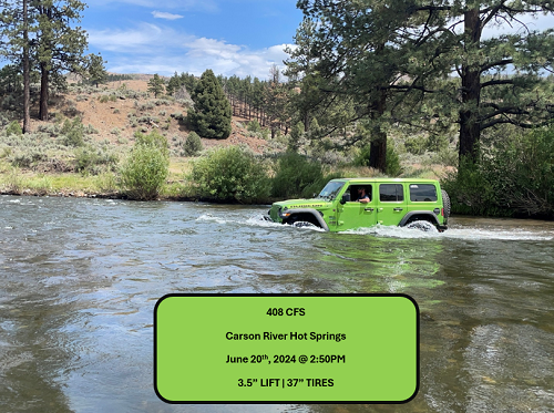
Cubic feet per second (CFS) is a measurement used to describe the flow rate of water in rivers and streams.
It represents the volume of water passing a specific point in the river each second. Specifically, 1 cubic foot equals
approximately 7.48 gallons of water, so a flow of 100 CFS means 748 gallons of water are flowing past a point every second.
Depth and Speed Correlation
As CFS increases, the depth and speed of the river generally increase. Even if a river looks shallow, high CFS can mean faster-moving water, which can make a crossing more dangerous. The speed of the current and the water’s force can make controlling the vehicle more difficult.
Hydrodynamic Pressure
At higher flow rates, the force of the water increases. This force pushes against the sides and undercarriage of the vehicle, potentially causing it to float or lose traction. Water flowing at 200-500 CFS may already be strong enough to move or destabilize a vehicle, especially if the depth reaches the vehicle's axle height.
Other Considerations
Water Depth: CFS doesn't directly tell you the water depth, but it usually correlates. Always check the depth of the river as well. Terrain: Rocky, uneven riverbeds, combined with strong flow, can make vehicle control harder. Vehicle Design: 4x4 vehicles with good ground clearance and water wading capabilities are more suited for river crossings.
So what's the magic number?
It's difficult to specify a safe CFS value for river crossings because many variables come into play. Every vehicle has different capabilities, such as clearance, tire size, and weight, which affect how it handles water flow. Additionally, driver skill levels vary, and the river's depth, speed, and the presence of obstacles like rocks or hidden holes can drastically change the situation. Even a seemingly low CFS might be dangerous in one spot but safe in another. These factors make each crossing unique, so there's no universal "safe" CFS for everyone.
Winter Effects on Data
During the winter season, ice can form around water gauges, which can significantly impact the accuracy of river flow data. Ice buildup may obstruct the gauge or alter the way water flows past it, leading to potentially incorrect measurements.
El Camino del Diablo (“The Devil’s Highway”) is a remote, historic desert route stretching roughly 130 miles across southern Arizona from near Ajo to Yuma. Originally used by Native Americans and later Spanish explorers, the trail cuts through some of the most isolated terrain in the Southwest, including the Barry M. Goldwater Range and Cabeza Prieta National Wildlife Refuge. Expect long stretches of rugged dirt road, deep sand, sharp rocks, and zero services—this is a true overland route where self-sufficiency is critical. The scenery is stark and beautiful, with expansive desert valleys, volcanic mountains, and frequent wildlife sightings. Due to its remoteness and exposure, it’s best run in cooler months with a well-prepared vehicle, extra fuel, and emergency supplies.